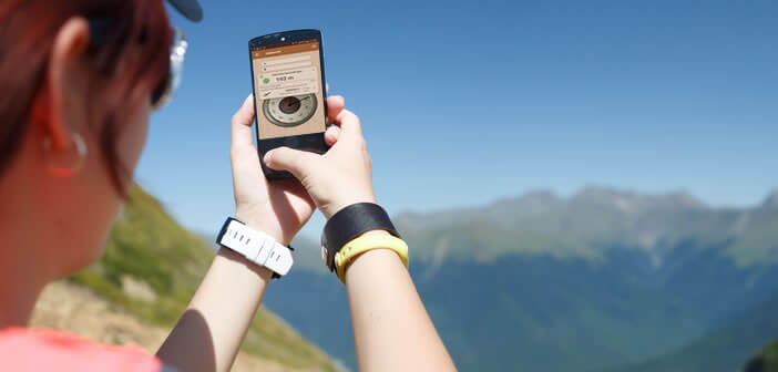
Lovers of outdoor activities such as walking, mountain biking or hiking very often need to know precisely the altitude of the place where it is located. If you already have an Android smartphone, there is no need to invest in an altimeter watch. Today there are countless applications on the Play Store allowing you to display the altitude on the screen of a smartphone. To help you choose the altimeter that suits you, we offer a small selection..
Transforming a smartphone into an altimeter
Sports applications, connected watches and bracelets have experienced unprecedented success in recent months. More and more sportswomen are using them to measure their sports performance and monitor physical efforts.
Unfortunately, these sports apps do not always offer the functions expected on this type of device. This is the case for example of the altimeter function . However, this kind of information is particularly useful, not to say essential, especially in editing..
For example, it allows hikers and fans of outdoor activity to know the difference in altitude during a running race, a mountain walk or an exercise. If the function is missing from your bracelet, you will need to use a third-party application. 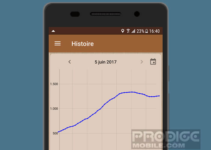 Coupled with the GPS of your smartphone, these tools will allow you to know exactly what your altitude is and the cumulative elevation gain of your race.
Little reminder to those who are allergic to mathematics, the difference in height corresponds to the difference in altitude between two geographical points. To put it simply, if your starting point is at 250 m above sea level and your end point is at 1000 m above sea level, this route then offers an overall elevation of 750 m..
Accurate altimeter
The Accurate Altimeter app is certainly one of the most used solutions on Android. Thanks to it, you will be able to know altitude wherever you are. Very practical to know the difference in altitude during mountain walks. The Accurate Altimeter application offers three methods for measuring altitude . 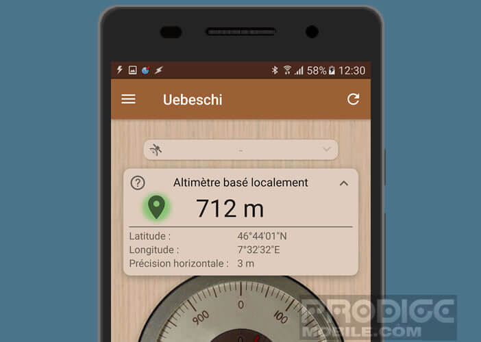
GPS altimeter
The calculation can be done by triangulation using the GPS chip on your smartphone. This solution has the advantage of working everywhere, even without any network connection as is very often the case in the mountains.
Please note that the accuracy varies depending on the weather conditions. If the weather is overcast and the reception of satellites limited, the margin of error can be significant and the calculation less precise. Another negative point, this solution is particularly slow. Sometimes you have to wait several minutes before getting the result.
Barometric altimeter
The application is also able to define your altitude thanks to the atmospheric pressure sensor integrated in the vast majority of smartphones. Please note, this method can only work if you have taken the trouble to calibrate your device before going on a hike. 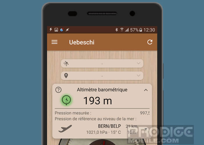
In fact, the application will use atmospheric pressure to determine the altitude. Problem this varies with weather conditions. You will therefore need to calibrate your smartphone in the place where you want to use it.
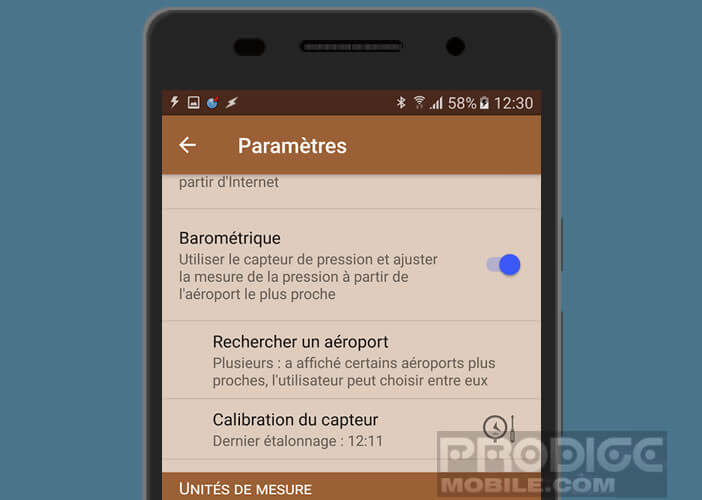 To do this, simply enter the information given by the weather station nearest to you in the parameters panel. This step is essential for the proper functioning of the barometer tool of this altimeter. Otherwise, the values obtained will not be correct.
Find the altitude of a place thanks to the internet
Altimeter and compass are two essential tools for all hikers. However, a smartphone with an internet connection can very easily find the altitude of a given place. This system using the Wi-Fi or 4G connection of the phone offers very good results. Unfortunately it will not be of any use to you in the open country or in the high mountains.
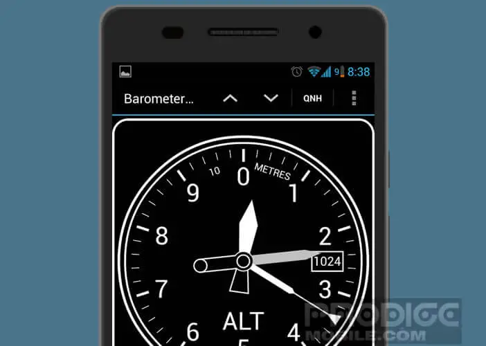
DashClock Altimeter Barometer
DashClock is one of the most popular altimeters on the Play Store. This success, it owes above all to its very pretty interface as well as to its offline mode which allows to obtain the altitude of a place without GPS, nor internet connection.
 This application also allows you to keep track of the cumulative elevation gain by recording your altitude at regular intervals. The values can be obtained either in meters or feet.
Finally, last important point, the application does not display any advertising. Just before using it, do not forget to set the atmospheric pressure using the QNH value of the airport located near you.
The essential applications for hiking
Never compromise with security when you go hiking. Good hiking shoes, warm clothes, drinks, food and of course a smartphone equipped with applications capable of locating you and finding your way in the mountains.
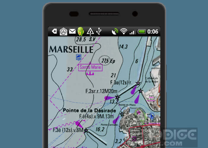
If you are used to using Google Maps or Waze while traveling, be aware that when hiking these GPS applications you will not be of any use. For walks in the mountains or in the countryside, you will need to invest in very detailed maps like those offered by the IGN (National Institute of Geographic and Forest Information).
Trails, rivers, springs, caves, horse tracks, refuge they are of a frightening precision. Nothing is missing. Please note these maps are relatively expensive and mainly cover forests, the coast and mountain ranges.
iPhiGéNie
Behind this strange name hides in fact one of the reference mapping applications. Using the interface is not very intuitive and requires a little time to adapt. 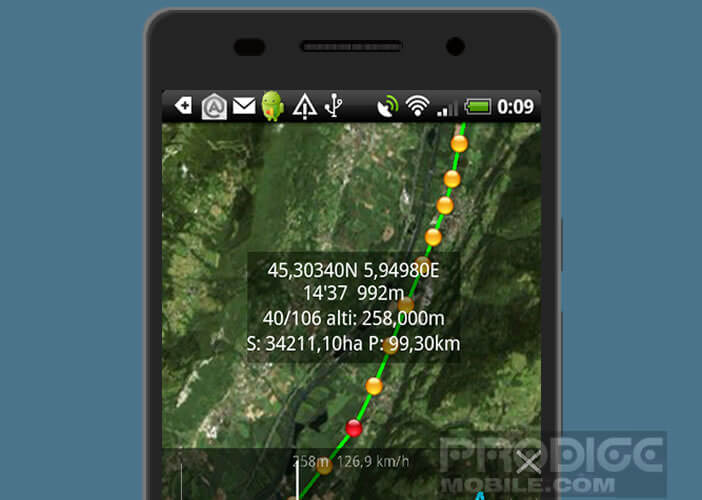 But once its functioning assimilated, iPhiGéNie proves to be of a formidable efficiency.
We can annotate walks, superimpose maps, use the aerial mode, add markers, create tracks etc ... All the maps displayed on the application are automatically saved in the internal memory of the device can then be consulted offline.
 Please note that in order to use the cards, you must subscribe to a paid subscription to the Géoportail. Note that when installing the application, you get a free 7-day trial.